Africa deserves its true scale: the U.N. map vote and the lone U.S. objection
An African-led resolution won 164 votes. The United States alone voted no. Here is what the decision changes—and why The Black Angle supports it.
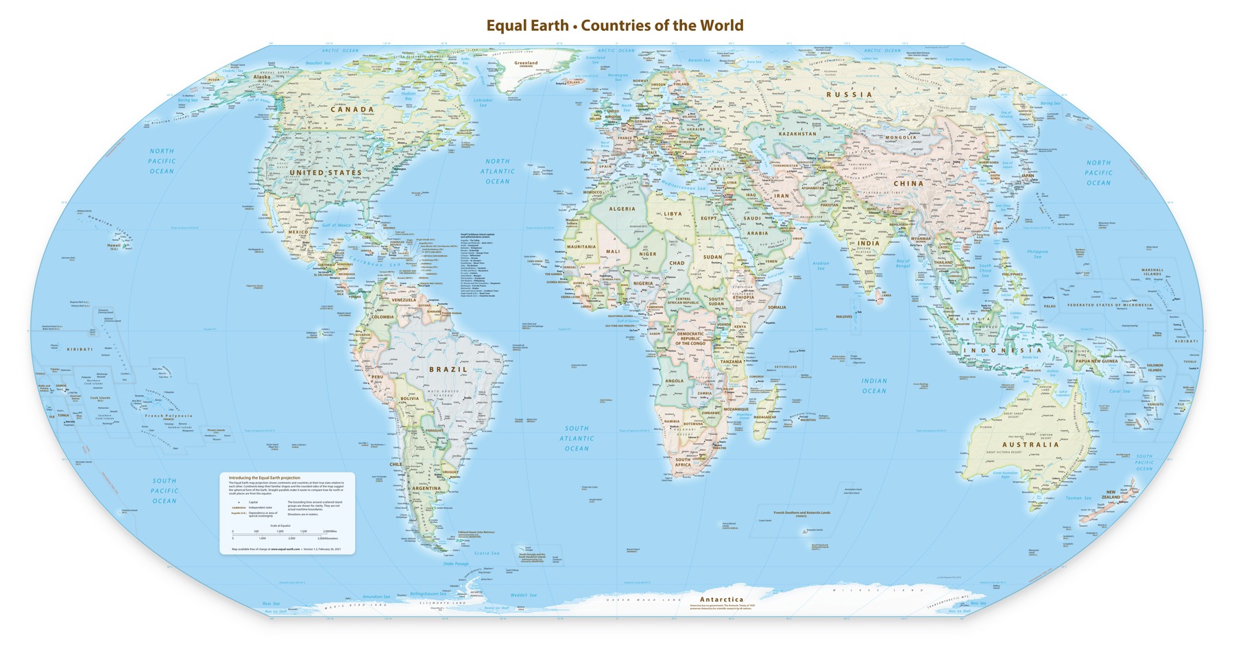
Africa does not need to be made bigger. It needs to be shown at its actual scale. The Black Angle supports the African-led effort to replace misleading size comparisons in classroom and general-reference maps with equal-area projections. We regard the campaign’s success at the United Nations as a meaningful victory for African representation—and a reason to teach geography more honestly.
On September 4, 2026, the U.N. General Assembly adopted the “Correct the Map” resolution by 164 votes to one, with six abstentions. Togo led the initiative on behalf of African states. The U.N. meeting transcript records the tally and the American delegation’s announcement that it would vote against the text. Reuters independently identifies the United States as the only no vote. The claim that both the United States and Israel voted against this resolution is therefore incorrect.
The problem is familiar: on the Mercator projection, Greenland can appear comparable to Africa, although Africa is about 14 times larger. Mercator enlarges areas farther from the equator relative to equatorial regions. Its historical navigation purpose helps explain the mathematics; it does not make it the best map for teaching the relative sizes of continents. Equal Earth preserves those relative areas. No flat projection preserves every property of a globe.
The African Union welcomed the vote and urged educational systems, publishers, international institutions and digital platforms to use representations that better reflect land area. Its campaign frames the issue as part of Africa’s ability to represent itself accurately. The resolution is not a binding order replacing every world map, and it does not ban Mercator’s navigational uses. A vote is a beginning; textbooks, teaching materials and actual adoption will determine its practical reach.
The U.S. objection was political. Its representative argued that the initiative was part of a broader ideological project involving reparations and cognitive justice, and diverted attention from the U.N.’s central work. That is Washington’s stated explanation. The Black Angle rejects the idea that improving Africa’s representation is an unworthy distraction. Readers can criticize this position forcefully without inventing another country’s vote or presenting an unproven motive as established fact.
Accuracy also requires separating map projection from border disputes. Several delegations raised concerns about territorial depictions on particular maps while supporting more accurate relative areas. An equal-area projection is a mathematical method; a mapmaker’s boundary choices are a separate issue. Supporting Africa’s true scale does not require endorsing every border drawn on every Equal Earth map.
For Black readers in the United States and across the diaspora, the importance goes beyond a larger-looking outline. We believe children should encounter Africa as a continent of its real geographic scale, not through a visual comparison that repeatedly diminishes it. That is a defensible pro-Black position precisely because it rests on evidence. The achievement is substantial enough to celebrate without adding a false Israel claim.
Reported facts were checked against the U.N. meeting transcript, African Union statements and Reuters. This is a retrospective editorial about the September 4 vote, not a new vote today. The publication’s support and criticism are identified as opinion. AI-assisted research and writing.
Published by The Black Angle. Editorial standards & corrections.
The conversation (0)
Bring your perspective. Keep it thoughtful, relevant, and respectful. Community guidelines
Sign in or create an account to comment under your username. You can also comment as a guest; guest names are not verified.
Loading the conversation…